FJ Dynamics V1t GNSS RTK Rover
FJ Dynamics Authorized Dealer: Warranty Included
- Fast and FREE Shipping! (for continental U.S.)
- Easy 30-Day Returns
- No Sales Tax (Excluding WY)
- Questions? Call us (888) 726-4343 or live chat

FJ Dynamics Authorized Dealer: Warranty Included
CM - Level Accuracy: It ensures accurate measurement data for each location. You can maximize your productivity and reduce errors in your work.

Discover CM-level High Accuracy
With CM-level precision, the GNSS RTK Rover ensures that your measurements and data collection are exceptionally accurate, greatly reducing the margin of error in your surveying projects. This level of detail allows for more informed decision-making, as well as increased confidence in your results.
Upgrade Your Surveying Equipment with IMU Technology
Effortlessly Obtain Tilt Measurements and Save Valuable Time and Resources. Say Goodbye to Manual Leveling and Additional Surveying Equipment. Enjoy Uninterrupted, High-Precision Data Collection on Varied Terrain. It supports a tilt range of up to 60 degrees, with an accuracy of 2.5cm at 30 degrees.
Master Your GNSS Survey with Field Controller E200
Field Controller E200 with stunning 5" high brightness display. IP67-rated, you can easily use it on rainy days. Enjoy seamless connectivity with SIM card support, Wi-Fi, and Bluetooth features. Navigate effortlessly through its smooth Android operating system and Trion Survey software, delivering outstanding measurement outcomes and an extraordinary GNSS survey experience.

Master Every Industry with Your All-in-One Measurement Solution
Boost your performance across multiple industries with the GNSS RTK Rover, a versatile and highly precise surveying equipment for diverse applications. Tackle road construction, digital machinery, resource exploration, engineering monitoring, precision agriculture, and marine projects effortlessly. The RTK Rover is your ultimate solution for all your measurement needs, delivering high accuracy and reliability.

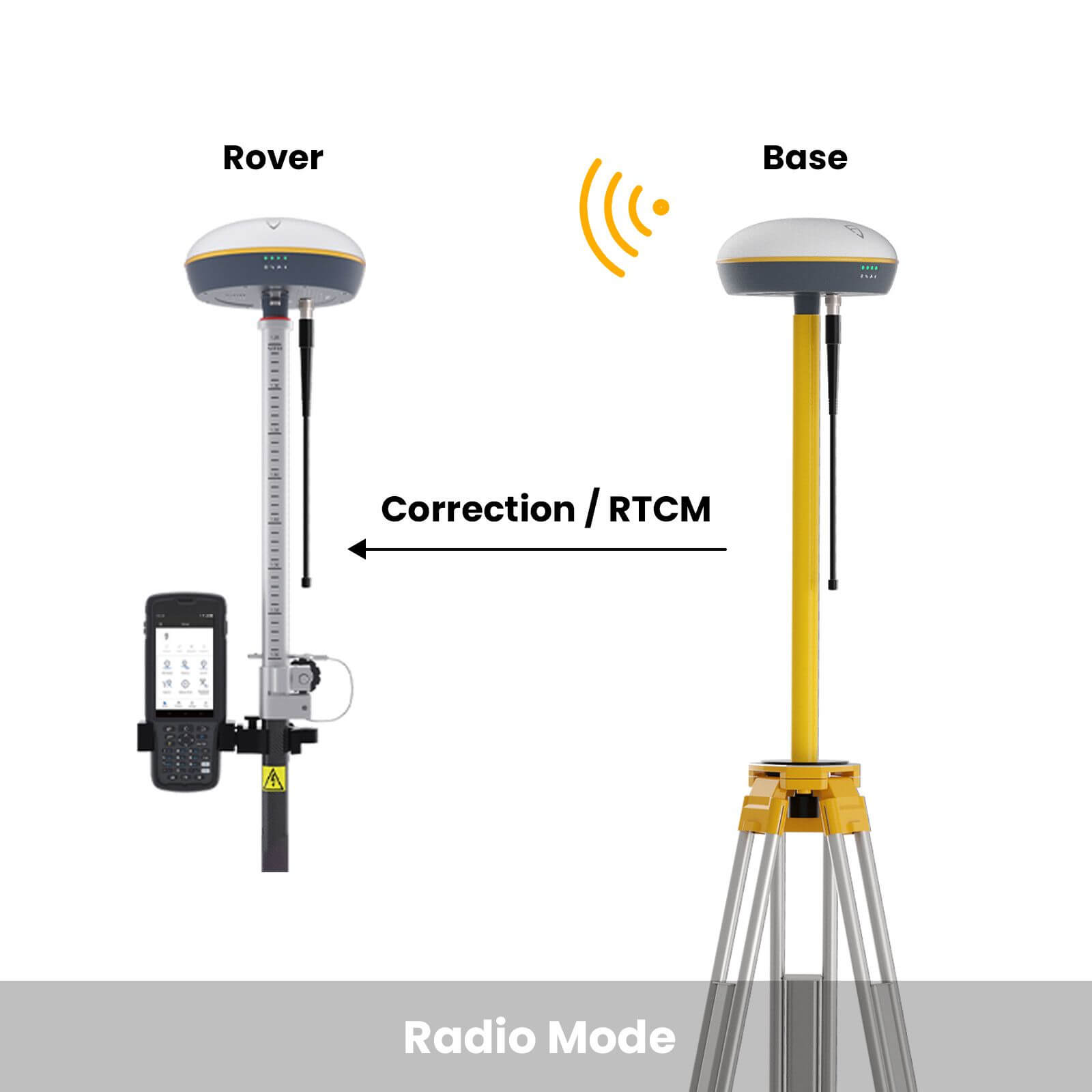
Featuring various work modes - Radio and NTRIP - for smooth RTK signal access. Use radio mode with our V1 Survey Base for a maximum 8km coverage with ideal condition. Or, connect via NTRIP with a complimentary or premium account to suit your requirements.


The V1 series has passed the IP67 rating and the intensive test of 1.5m drop resistance, which is suitable for the measurement work of more and more users.

Q1: What is the accuracy of the V1t tilt measurement? What is the maximum angle that can be supported?
Ideally, no less than 10mm + 0.7mm/degree, and up to 60 degrees. In practice, the accuracy is around 2.5cm at a tilt of 30 degrees, so a tilt of roughly 30 degrees is sufficient for use.
Q2: Can the V1t GNSS RTK Rover work with other brands of base stations?
When connecting to other brands of survey base stations, you need to pay attention to the radio protocol and differential data format, please provide the specific model or parameter information of your other brand of survey base stations, and our engineers will help you to determine.
Q3: What are the protocols of V1t GNSS RTK Rover's built-in radio and what is the operating range?
The V1t can support TRIMTALK, TRIMMARKIII, TT450S, TRANSEOTS, atel 3AS 4FSK; under ideal conditions the radio can work up to 8km, under normal conditions, about 5km, in case of external interference factors, the working distance may be about 2-3km, the specific use effect is related to external interference factors. The specific use effect is related to the external interference factor.
Q4: Can the V1t GNSS RTK Rover's battery be replaced? What is the battery capacity?
The V1t's battery is not replaceable, with a capacity of 6700mAh, the station can last up to 15h under normal conditions.
Q5: Can I insert a SIM card into the V1t? How do I connect to the Ntrip?
The V1t GNSS receiver does not allow the insertion of a SIM card. The E200 GNSS survey controller can be connected to Ntrip using the controller network by inserting a SIM card or connecting to WiFi.